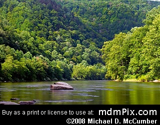
Erratic Rocks and Island in Youghiogheny River
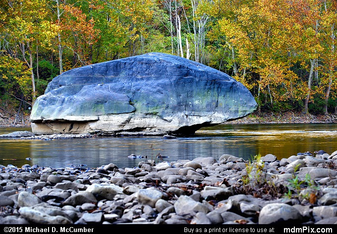
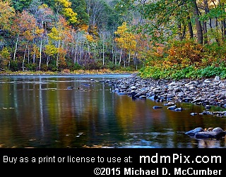
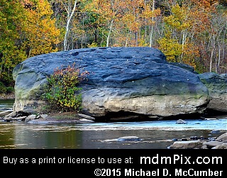
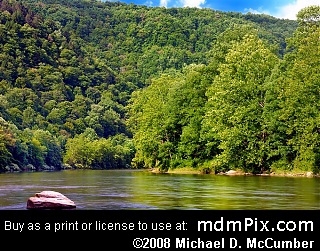
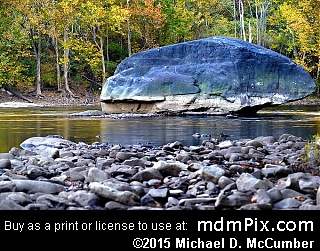
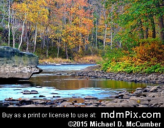
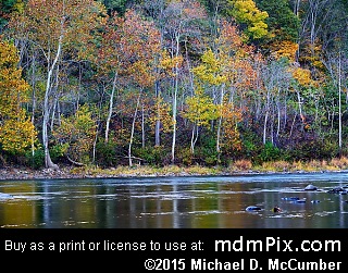
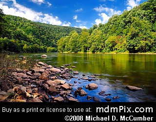
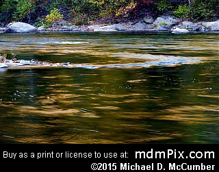
When approaching the river the sight of several large blue limestone rocks, the closest being up to ten yards from shore, immediately draws your attention as you approach the river rock covered shoreline of the Youghiogheny River. About a hundred yards from this point is an island with sycamore trees that is occasionally, during high flow periods, surrounded by thunderous rapids. Looking west, past the island, is an impressive view of Chestnut Ridge sloping down into the Youghiogheny Gorge and appears as heavily forested wall rising up from the river. This spot offers one of easiest places to get a good view of the river and surrounding terrain in this area and is only a short walk down a side trail from the Great Allegheny Passage Trail. It's a great place to take a break and check out the gorgeous scenery surrounding you.
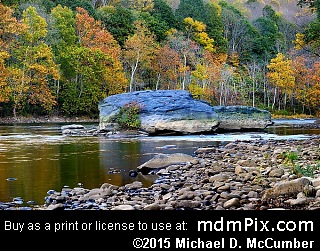
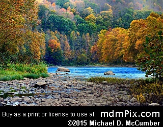
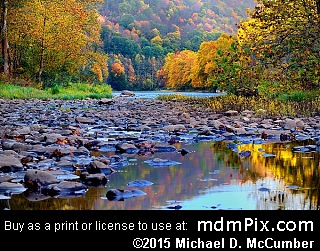
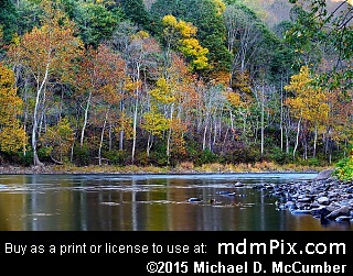
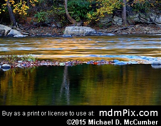
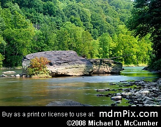
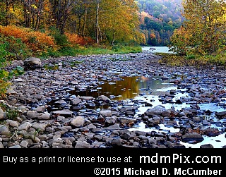
The water level of the river can determine the type of experience you will have here. Spring rains may have the river so high that the shoreline is completely submerged leaving you without a place to walk in which case all that will be visible is the partially submerged island surrounded by roaring water. Even the blue limestone rocks may find themselves nearly drowning by the swift Youghiogheny River currents. At other times a pond of water cut off from the river will be all that separates the island from the shore with plenty of exposed rocks to enable walking to the island for a unique view of Chestnut Ridge from the island's rocky shore. There are rapids near the island even when the river is low as rocks normally deep beneath the waters are now obstacles for the water's flow. Most visits here will find the island inaccessible but the shoreline walkable, although rough, with slippery rocks that can be challenging on the ankles. When the water level is low enough the channel between the river and island is nothing but a field of rounded smooth river rock.
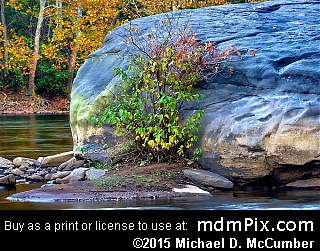
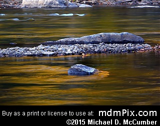
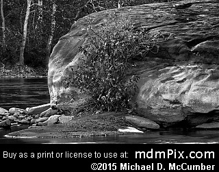
The blue limestone is from a formation higher up on the ridge and has seemingly been rolled down to this low elevation and location by some catastrophic force but more likely a glacier during the last ice age. The blue tinted rocks are enormous. The one closest to the shore is shaped almost like a triangle and is up to 40 feet wide, but only ten feet in height is visible above the river. The rock furthest from the shore but closest to the island is 36 feet long and considerably more narrow. Some other rocks are smaller and of a different color nearby. There happens to be a 100 yard long gouge in the ridge directly above the opposite shore where these rocks may have originated, but that would have required them to travel a distance of nearly 450 yards. There a wall of exposed limestone exists, so it's possible a glacier pushed them down to this location during the last ice age.
Around the next bend, to the southeast, is the deepest part of the Chestnut Ridge Water Gap with its interesting geological formations but the terrain leading down to the river there is too steep to be able to get a view clear of trees without the risk of injury.
Caution
The shoreline river rocks are very treacherous to walk on as they're slippery and can shift when walking on them. Watch out for snakes. Do not walk through the thick vegetation beyond the shoreline as it may have ticks.
How to Access
From the closest parking lot, follow the Great Allegheny Passage Trail south towards Ohiopyle approximately 1.8 miles to where you'll see a side trail leading down to the river and the large rocks.
Get Directions to Parking Using Google Maps:
Adjacent Places
More Information
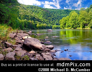
The river is about 250 feet wide in this location. Thick jungle like vegetation tends to grow along the river beyond the band of rocks.
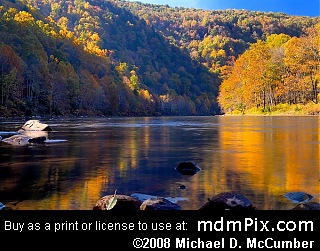
If careful and the river level is low enough you can follow the river south by walking on rocks and see around the bend towards the main part of the Chestnut Ridge Water Gap.
Erratic Rocks and Island in Youghiogheny River is located in Pennsylvania, near Connellsville, Pennsylvania.
Map for Place